Description
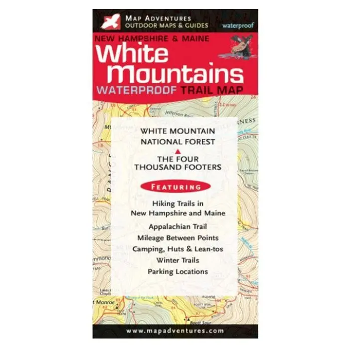
This waterproof, two-sided, easy-to-read trail map (28″ x 24″, folded to 4″ x 8″) covers 90 % of the White Mountain National Forest, including all 48 4000-foot peaks. The trails show mileages between points, and viewpoints are highlighted with stars. Scale is 1:70,000 for map covering western Whites (Franconia Notch/Lincoln to Crawford Notch/North Conway) and 1:50,000 for map covering Presidentials, Carters and Evans Notch area. Contour lines are at 100-foot intervals.
_________________________________________________
Explore more from our collection.
Reviews
There are no reviews yet.